Introduction to GIS (GIS-401/501)
This class introduces concepts, science and theory of GIS with hands-on experiences. After successful completion of the course, students will be able to demonstrate fundamental techniques of geospatial analysis and mapping.
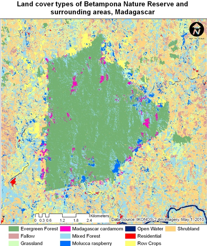
Intermediate GIS (GIS-402/502)
This course covers intermediate and advanced topics in GIS including remote sensing for GIS, geospatial statistics and GIS in biogeography. Each module is taught by a separate professor specialized in that particular area for 5 weeks during a semester.
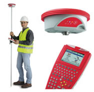
GIS in Civil Engineering (GIS-217)
This course discusses the fundamental concepts of GIS, the methods and software used to solve civil engineering problems. The course also covers skills to deal with remote sensing data, basic and differential GPS surveying to prepare students for today’s growing business needs in civil engineering companies and government agencies.
Introduction to Remote Sensing (GIS-403/503)
Fundamental knowledge on the physics of remote sensing, photogrammetry, multispectral, hyperspectral, thermal imaging and RADAR and LIDAR principles are reviewed in lectures while lab assignments cover image processing, environmental modeling & analysis. Course objective is to demonstrate present applications of RS in environmental sciences with software training in ENVI+IDL, SARscape.
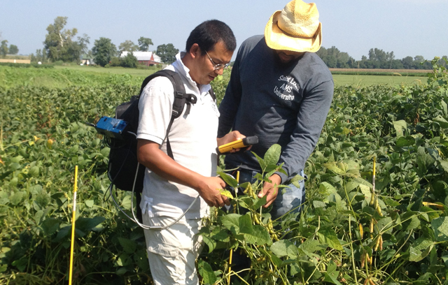
Geospatial Methods in Environmental Studies (GIS-404/504)
For students and professionals in Environmental Sciences, this course explores an integrated GIS and remote sensing approach to solve real-world environmental problems. Through hands-on projects, the course will also prepare students for today’s growing business needs in innovative server-based GIS solutions, relational databases and web mapping in an enterprise environment.
Microwave Remote Sensing: SAR principles, data processing and Applications (GIS-405/505)
The course covers principles of synthetic aperture radar (SAR), SAR satellites and data sources, SAR image processing, interpretation and applications. Popular data processing techniques, including SAR intensity processing, InSAR and DInSAR techniques, polarimetry tools/classification methods, Persistent Scatterer Interferometry are discussed through detailed step-by-step lab work on the processing chain including measuring earthquake deformation, land subsidence, landslides, building sinking, and tree height/health estimation, DEM generation, and various environmental applications.
InSAR - Syntheric Aperture Radar Interferometry (GIS-406/506)
This course focuses on providing application oriented forum on InSAR for geoscientists. Principles of InSAR, DInSAR, timeSAR are introduced through hands-on lab work on measuring earthquake deformation, volcanic unrest, land subsidence due to extraction of groundwater, oil, gas, and coal mining using both commercial and open-source software tools.
Programming for Remote Sensing/ GIS (GIS-593)
This course introduces introductory programming concepts in RS/GIS. By completing the course, students will be able to use and write scripts to customize RS/GIS applications. Students will choose one or more RS/GIS platform and explore some common functions, then use programming languages (IDL, Python, Java and PhP) to automate procedures, develop custom applications. Topics include ArcIDL, extending ENVI with IDL, designing program code to handle various coordinate systems, projections, and GIS web mapping applications.
GIS Capstone (GIS485/585, offered as needed)
In this course, students will consolidate their coursework and demonstrate their mastery of remote sensing and/or GIS competencies through ongoing projects. Depending on whether student's research interests are in remote sensing or GIS, topics will cover spatial statistics, web GIS, database design, management and data mining with integrated remote sensing, GIS, GPS and InSAR and various applications of the techniques.
This class introduces concepts, science and theory of GIS with hands-on experiences. After successful completion of the course, students will be able to demonstrate fundamental techniques of geospatial analysis and mapping.
Intermediate GIS (GIS-402/502)
This course covers intermediate and advanced topics in GIS including remote sensing for GIS, geospatial statistics and GIS in biogeography. Each module is taught by a separate professor specialized in that particular area for 5 weeks during a semester.
GIS in Civil Engineering (GIS-217)
This course discusses the fundamental concepts of GIS, the methods and software used to solve civil engineering problems. The course also covers skills to deal with remote sensing data, basic and differential GPS surveying to prepare students for today’s growing business needs in civil engineering companies and government agencies.
Introduction to Remote Sensing (GIS-403/503)
Fundamental knowledge on the physics of remote sensing, photogrammetry, multispectral, hyperspectral, thermal imaging and RADAR and LIDAR principles are reviewed in lectures while lab assignments cover image processing, environmental modeling & analysis. Course objective is to demonstrate present applications of RS in environmental sciences with software training in ENVI+IDL, SARscape.
Geospatial Methods in Environmental Studies (GIS-404/504)
For students and professionals in Environmental Sciences, this course explores an integrated GIS and remote sensing approach to solve real-world environmental problems. Through hands-on projects, the course will also prepare students for today’s growing business needs in innovative server-based GIS solutions, relational databases and web mapping in an enterprise environment.
Microwave Remote Sensing: SAR principles, data processing and Applications (GIS-405/505)
The course covers principles of synthetic aperture radar (SAR), SAR satellites and data sources, SAR image processing, interpretation and applications. Popular data processing techniques, including SAR intensity processing, InSAR and DInSAR techniques, polarimetry tools/classification methods, Persistent Scatterer Interferometry are discussed through detailed step-by-step lab work on the processing chain including measuring earthquake deformation, land subsidence, landslides, building sinking, and tree height/health estimation, DEM generation, and various environmental applications.
InSAR - Syntheric Aperture Radar Interferometry (GIS-406/506)
This course focuses on providing application oriented forum on InSAR for geoscientists. Principles of InSAR, DInSAR, timeSAR are introduced through hands-on lab work on measuring earthquake deformation, volcanic unrest, land subsidence due to extraction of groundwater, oil, gas, and coal mining using both commercial and open-source software tools.
Programming for Remote Sensing/ GIS (GIS-593)
This course introduces introductory programming concepts in RS/GIS. By completing the course, students will be able to use and write scripts to customize RS/GIS applications. Students will choose one or more RS/GIS platform and explore some common functions, then use programming languages (IDL, Python, Java and PhP) to automate procedures, develop custom applications. Topics include ArcIDL, extending ENVI with IDL, designing program code to handle various coordinate systems, projections, and GIS web mapping applications.
GIS Capstone (GIS485/585, offered as needed)
In this course, students will consolidate their coursework and demonstrate their mastery of remote sensing and/or GIS competencies through ongoing projects. Depending on whether student's research interests are in remote sensing or GIS, topics will cover spatial statistics, web GIS, database design, management and data mining with integrated remote sensing, GIS, GPS and InSAR and various applications of the techniques.