|
Vasit Sagan is Associate Vice President for Geospatial Science at Saint Louis University and Chief Scientist for Food Security & Digital Ag. of the Taylor Geospatial Institute (TGI), Professor of Geospatial Science in the Department of Earth and Atmospheric Sciences and Professor of Computer Science with the Department of Computer Science at Saint Louis University, and Director of SLU’s Remote Sensing Lab. Previously, Dr. Sagan served as the Acting/Founding Director, then the Deputy Director of TGI from 4/22 to 3/24, and led the TGI’s efforts to harness the power of partnership with industry, government agencies, and research entities to develop geospatial research addressing some of the world’s greatest challenges. From 2018 to 2022, he served as the founding Director of Saint Louis University’s Geospatial Institute (GeoSLU) and directed SLU’s campus-wide geospatial research and training programs. Under his leadership, GeoSLU secured over $10M in external grants; positioned SLU as a regional geospatial leader, and collaboratively shaped TGI’s vision, mission, and scientific priorities through convening dozens of faculty and stakeholders including leaders from academia, government, and industry.
Sagan’s research focuses on developing state-of-the-art computer vision technologies, AI/machine learning, and sensor/information fusion algorithms for studying food and water security, ecosystems, and social instability from local to global scales. He has been PI/Co-PI on over $50M in grant funding and has authored over 150 peer-reviewed journal publications, many of which have been recognized through best paper awards. He has served on NASA review panels and reviewed several NSF proposals and numerous journal papers. He has also advised and mentored numerous doctoral students, master’s students, and postdocs and served as a member of dozens of doctoral dissertation committees. He currently serves as a member of the National Geospatial Advisory Committee under the U.S. Department of the Interior, where he is chairing the committee to advance U.S. global geospatial excellence and innovation. He is also Associate Editor of the ISPRS Journal of Photogrammetry and Remote Sensing, Director of the MissouriView Consortium, and Primary Investigator for NGA-SLU CRADA since 2018. He was involved in NASA's Air Quality Applications Science Team and NASA's recent mission focused on studying the atmospheric composition, TEMPO (Tropospheric Emissions: Measurement of Pollution). He was the Vice President and President of ASPRS Heartland Region from 2013-2015. |
Current Faculty and Postdocs
|
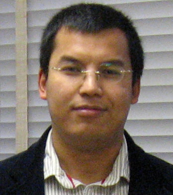
Dr. Yusupujiang Aimaiti is a Research Scientist with the Remote Sensing Lab at Saint Louis University. He earned his Ph.D. degree in Urban environment systems from Chiba University. He was a Postdoctoral Fellow with the Center for Remote Sensing at Boston University from 01 October 2021 to 30 September 2022. His past research focused on Interferometric Synthetic Aperture Radar (InSAR) and its application to natural and human-induced hazards. His current research focus is on the synergetic use of optical and SAR data in crop monitoring and damage assessment.
|

|
Dr. Alifu Haireti is a Geospatial Computing Engineer at Saint Louis University. He earned his Ph.D. degree in Environmental Remote Sensing from Chiba University, Japan. His current work focuses on developing climate resistant smart crops that can sequester more carbon with minimal water and nutrient input using remote sensing and multi-sensor data fusion.
|
|
Dr. Felipe Alencar Lopes is a Research Scientist with the Remote Sensing Lab at Saint Louis University. In 2020, he earned his Ph.D. degree in Computer Science from the Federal University of Pernambuco, Brazil. He worked as a research assistant at Karlsruhe Institute of Technology, Germany, during the 2016-2017 academic year. Since 2018 has been a lecturer at the Federal Institute of Alagoas, Brazil, and recently founded the Laboratory of Data Analysis and Engineering. His past research focused on smart irrigation, models at runtime, and artificial intelligence applied to networks. Currently, his research focuses on combining remote sensing and machine learning techniques for assessing crop evapotranspiration.
His current work is funded by an NSF grant "Collaborative Research: CPS: TTP Option: Medium: Sharing Farm Intelligence via Edge Computing," focused on algorithm development and software implementation for remote sensing. |

|
Dr. Derek Tesser is a Research Scientist at Saint Louis University's Remote Sensing Lab. He earned his Ph.D. in Earth and Environmental Sciences from the City University of New York, where he focused on imaging radar and lidar data from satellite and drones to study tropical forest structure and ecosystem functioning for biodiversity and conservation purposes. Derek has completed research internships with NASA’s Jet Propulsion Lab ECOSTRESS mission, studying plant water use in tropical forests and precision agriculture applications, including vineyard management in Sonoma, California. He has participated in various NASA wetland campaigns, including calibration/validation efforts in the Amazon for the upcoming NISAR mission.
|
|
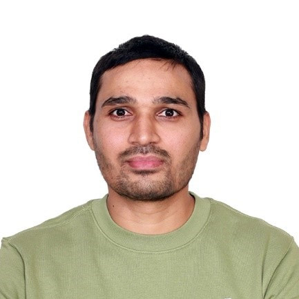
Dr. Ajay Kumar Patel is a Postdoctoral Fellow with the Remote Sensing Lab at Saint Louis University. He earned his Ph.D. degree in Geomatics Engineering Group from the Indian Institute of Technology Roorkee, India. He was a Postdoctoral Researcher with the Department of Smart Agricultural Systems at Chungnam National University, South Korea, from July 2021 to December 2022. His past research focused on plant phenotyping using 3D LiDAR point clouds and hyperspectral remote sensing. His current research focuses on assessment of soil fertility status using the hyperspectral imaging technique.
|

|
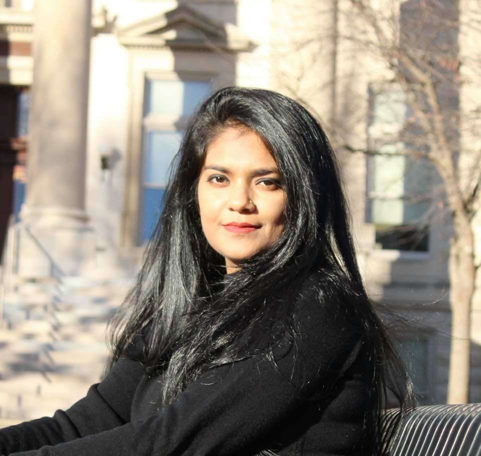
Gizelle Cota is a Geospatial Data Scientist with the Remote Sensing Lab at Saint Louis University. She earned her Masters degree in Geographic Information Science and Remote Sensing from Saint Louis University. Before this role, she was working at St Louis Development Corporation as a GIS Analyst.
Her masters thesis focused on using Machine Learning to identify Land Use Land Cover changes in a protected nature reserve in Betampona, Madagascar. |

|
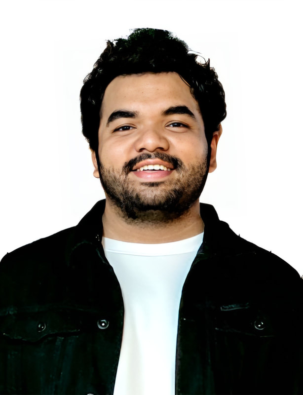
Omar Al Akkad is a Geospatial Software Engineer and a PhD student in the Geoinformatics and Geospatial Analytics program. He holds a B.S. degree in Electrical Engineering from Alfaisal University (2019), Saudi Arabia, and an M.S. degree in Artificial Intelligence from Saint Louis University (2023), Missouri, USA. Omar's current research involves remote sensing, machine learning, deep learning, and computer vision for plant yield prediction and disease detection. He also leads the development of Hyperfidelis, a cutting-edge software toolkit designed to advance precision agriculture through GeoAI.
|

|
Cagri Gul is a Geospatial Data Scientist with the Remote Sensing Lab. He earned his B.S. in Geomatics Engineering from Ondokuz Mayıs University, Turkiye (2012). Between 2014 and 2022, He worked as a Geomatic Engineer and Manager at the Republic of Turkiye Ministry of National Education, Department of GIS and Property. He joined the Remote Sensing Lab in Spring 2022 with a Republic of Türkiye government scholarship and earned his M.S. degree in Geographic Information Science program in May 2024. His past research focused on improving InSAR accuracy for slow deformation monitoring with LiDAR and GPS. Currently, he works for the division of UAV & Ground systems as a Geospatial Data Scientist.
|

|
You should be here!
We are looking to fill a dozen postdocs and research scientists in the lab. Please come join us! |
Current Graduate Students
|
Supria Sarkar is a PhD student in Geoinformatics and Geospatial Analytics program. She completed her BS degree in Soil, Water, and Environment from the University of Dhaka (2018), Bangladesh and MSc in Geography and Environmental Resources from Southern Illinois University Carbondale (2021), United States. Her current research interest includes remote sensing, unmanned aerial system, machine learning and computer vision for monitoring crop biophysical parameters and yield. She joined the Remote Sensing Lab in Summer 2021.
Dissertation: SeedAI for the Planet: using AI and Planet imagery for global seed composition estimation |
|
Ashutosh Pawar is a Ph.D. student in the Geoinformatics and Geospatial Analytics program. He previously worked as an AI Developer at an Agri-Tech startup from February 2022 to August 2023. He holds an M.Sc. in Data Science and Spatial Analytics from Symbiosis International University (2022) and a B.Sc. in Computer Science from Savitribai Phule Pune University (2020). His current research is focused on Carbon Capture in Plants using Deep Learning and Drone Imagery. He joined the Remote Sensing Lab in August 2023.
Dissertation: Aboveground biomass and carbon stock estimation using UAV photogrammetry and machine learning. |
|
Nirab Shrestha is a Ph.D. student in Geoinformatics and Geospatial Analytics program. He completed his bachelor's in electrical and Electronics from Kathmandu University, Dhulikhel (2013) and Masters in Climate Change and Development from Institute of Engineering, Pulchowk (2022). His past experiences involve modelling of Hydrological Response to Changes in Climate and Glacier in a Glacierized Region in Nepal Himalaya and Preparation of Flood Hazard Map and Fixing Warning and Danger Level of Bagmati and Karnali Basin of Nepal. His current research focuses on interest includes remote sensing, unmanned aerial system, machine learning and computer vision for monitoring crop biophysical parameters and productivity. He joined the Remote Sensing Lab in August 2023.
Dissertation: TBD |
|
Hossain Idrish is a PhD student in the Geoinformatics and Geospatial Analytics program. He earned his Bachelor's and Master's degrees in Geography and Environment from the University of Dhaka, Bangladesh. In July 2017, he began his professional career with a strong focus on teaching Geography in Bangladesh. He joined the Remote Sensing Lab as a research assistant in Summer 2023. Prior to joining the RSL, he earned another Master's in Geographic Information Science & Geoenvironment from Western Illinois University.
Dissertation: TBD |
|
Justin Vilbig is a PhD student in Geoinformatics and Geospatial Analytics program. He earned his B.S. in Anthropology and Political Science from Truman State University in 2010 and his M.S. in Sustainability with a Graduate Certificate in GIS Technology from SLU in 2017. His research focus is on the application of geospatial technology to archaeological exploration in North America. The use of multispectral data and drone imagery have been valuable methods for his research with archaeological mapping and feature detection.
Dissertation: Uncovering the past of Cahokia with hyperspectral, LiDAR, and photogrammetry data fusion |
|
Kristen Rhodes is a PhD student in Geoinformatics and Geospatial Analytics Ph.D. program. She earned her B.S. in Geography and Environmental Resources from Southern Illinois University Carbondale, IL (2005) and M.S. in Engineering Management from Missouri S&T Rolla, MO (2010). Her research interests focus on geospatial and remote sensing applications for monitoring food security threats caused by locust outbreaks.
Dissertation: Enhanced forecasting of locust outbreaks: integrative social-environmental modeling to contend global food insecurity |
|
Kevin Wells is a PhD student in Geoinformatics and Geospatial Analytics program. He completed a Bachelor of Science in Public Health (2014) and a Master of Public Health (2020), concentrating in Biosecurity and Disaster Preparedness at Saint Louis University. His current research interests include using machine learning and artificial intelligence applications to geospatially identify and analyze trends in wildlife trafficking and natural resource extraction.
Dissertation: Dark vessel detection by fusion of radio frequency data and SAR |

|
Bishal Roy is a PhD student in Geoinformatics and Geospatial Analytics program. He earned his B.S. in Geography and Environmental Science from Begum Rokeya University (2022), Rangpur, Bangladesh; He joined the Remote Sensing Lab in August 2022 and earned his M.S. degree in Geographic Information Science program in May 2024. His M.S research was focused on hyperspectral sensing of below ground carbon stock stored in plant root system. His current research interest includes remote sensing, unmanned aerial system, machine learning and computer vision for estimating below ground carbon stock.
Dissertation: TBD |

|
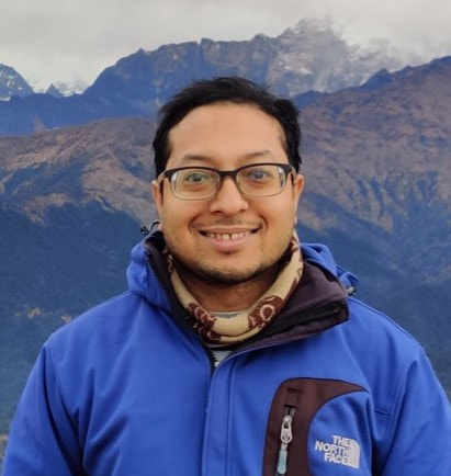
Aviskar Giri is a PhD student in Geoinformatics and Geospatial Analytics program and a Geospatial Data Scientist at Taylor Geospatial Institute. He earned a bachelor's degree in environmental studies with a minor in Mathematics from Concordia College in Moorhead, Minnesota. Aviskar began his career as a project manager at Fargo Consultants, a civil engineering firm, where he worked for two years. In 2021, he joined Saint Louis University (SLU) as a graduate student in Geographic Information Science. After completing his degree, Aviskar joined Taylor Geospatial Institute as a full-time geospatial data scientist. He is also pursuing a Ph.D. under Dr. Sagan, focusing on hyperspectral imaging of permafrost in Alaska, in conjunction with the Remote Sensing Lab.
Dissertation: TBD |

|
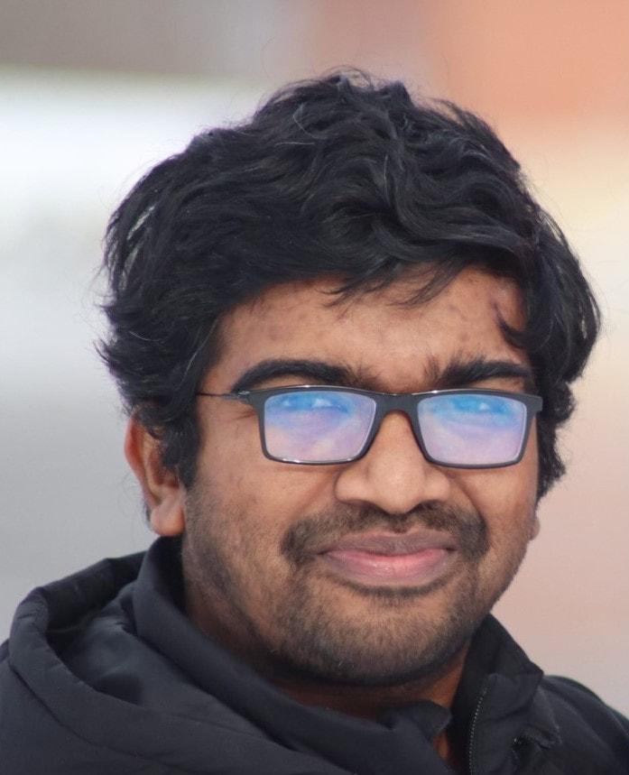
Mustafizur Rahaman is an M.S. student in the GIScience program, holding a B.S. in Computer Science and Engineering (2021) from North South University, Bangladesh. During his undergrad, he worked on the performance evaluation of deep learning models on noisy remote sensing data. Mustafizur's primary research interests include remote sensing, computer vision, and machine learning. He joined the Remote Sensing Lab in August 2023.
Thesis: Plant disease detection using hyperspectral image and deep learning. |

|
Abuduwanli Maiwulanjiang is an M.S. student in the GIScience program, holding an MSc degree in International Finance and Data Analytics from Tokyo Takushoku University, Japan. He was a Research Scientist with Remote Sensing Lab at Saint Louis University from 1 July 2023 to 30 June 2024. His work was focused on Seed composition estimation using indoor hyperspectral sensing. Currently, he is a research assistant with the remote sensing lab, assisting in field data collection and analysis for the data analytics team.
Thesis: TBD |
Past Postdocs and Research Faculty
Noor M. Al-Shakarji (2023-2024) was a Postdoctoral Fellow with the Remote Sensing Lab at Saint Louis University. She earned her Ph.D. and M.S. degree in Computer Science from the University of Missouri Columbia, and B.S. in Information Systems/Computer Science from the University of Technology, Iraq. Her past research focused on developing moving object detection algorithms for full-motion, wide aerial, and microscopy imagery using machine & deep learning approaches. Her postdoc work focused on building a foundational model for Soybean seed composition estimation using multi-source remote sensing imagery and machine learning.
Abuduwanli Maiwulanjiang (2023-2024) was a Research Scientist with Remote Sensing Lab at Saint Louis University from 1 July 2023 to 30 June 2024. His work was focused on seed composition estimation using indoor hyperspectral sensing.
Dr. Rohit Pathak (04/2021-12/2021) was a Postdoctoral Fellow with Remote Sensing Lab at Saint Louis University from April through December 2021. He earned his Ph.D. degree in Agricultural and Life Sciences in April 2021 from Mississippi State University. His postdoc work focused on remote sensing of crop nutrient and water use efficiencies using soil and acoustic signals with the goal of improving food security.
Dr. Maitiniyazi Maimaitijiang (2020-2021) was a postdoc, then a Remote Sensing and Imagery Scientist with Remote Sensing Lab at Saint Louis University from 1 July 2020 to 13 August 2021. He earned his Ph.D. degree in Integrated Applied Sciences program in June 2020. His postdoc and imagery scientist research focuses on UAV remote sensing and seed composition estimation. Starting Fall 2021, he has been with South Dakota State University as an Assistant Professor.
Dr. Nichole Gosselin (2019-2020) was a postdoctoral Fellow in geospatial data science in the Remote Sensing Lab from January 2019 to June 2020. Her research focused on the ozone effects agriculture and plant phenotyping and yield prediction using remote sensing integrated with machine learning and modeling (WRF and DSSAT).
Dr. Patrick Paheding (2/2017 - 8/2019), PostDoc Research Associate and Assistant Research Professor in the Remote Sensing Lab from 2017 - 2019. While he was in the lab, his research focused on Machine Learning, Computer Vision, Deep Learning and Remote Sensing. Dr. Paheding earned his Ph.D. degree (2016) in Electrical Engineering from University of Dayton, Ohio, USA.
Dr. Matthew Maimaitiyiming (08/2018-12/2020), was a visiting PostDoc Fellow in Remote Sensing Lab. His research focused on remote sensing of grapevine biophysical variables for characterizing tipping points of abiotic stress.
Dr. Maria Librada Chu (2011-2013) was a post-doctoral fellow with Remote Sensing Lab. Dr. Chu's research focused on a project examining the potential influence of climate change on hydrologic aspects of human and natural systems in the Midwestern U.S.
Past Graduate Students
Cagri Gul (2022-2024) earned his M.S. degree in Geographic Information Science program in May 2024. He earned his B.S. in Geomatics Engineering from Ondokuz Mayıs University, Turkiye (2012). Between 2014 and 2022, He worked as a Geomatic Engineer and Manager at the Republic of Turkiye Ministry of National Education, Department of GIS and Property. He joined the Remote Sensing Lab in Spring 2022. Thesis title: InSAR monitoring of land subsidence due to coal mining
Employment: TGI, Geospatial data scientist.
Imran Said (2022-2024) earned his M.S. degree in Artificial Intelligence in May 2024.He earned his B.S in CS from the Jomo Kenyatta University of Agriculture and Technology (JKUAT). He worked as a data engineer in Nairobi and joined the SLU in January 2022. Thesis title: Seed protein content estimation and genotype mapping with bench-top hyperspectral imaging
Employment:
Yahya Khan (2022-224) earned his M.S. degree in Geographic Information Science program in May 2024. He received B.S in Computer Science from Air University –Multan, Pakistan (2017) and M.E in Software Engineering from Wuhan University, Wuhan, China (2019). He joined the Remote Sensing Lab in August 2022.
Employment:
Khair Bonsasa (2022-2024) earned his M.S. degree in Geographic Information Science program in May 2024. He earned his B.A. in Political Science from Harris-Stowe State University (2022). During his undergraduate program, he conducted research that utilized the application of GIS software to study urban vegetation between 2020 to 2022. He joined the Remote Sensing Lab in the Summer of 2022. Thesis title: Mapping underground root architecture of perennial crops using ground penetrating radar.
Employment:
Juan Cruz Skobalski (2022-2023) earned his M.S. degree in Geographic Information Science program in December 2023. He earned his B.S. in Agronomy and Crop Science from University of Buenos Aires. He joined the Remote Sensing Lab in Spring 2022. Thesis topic: Bridging the gap between crop breeding and GeoAI: Soybean yield prediction from multispectral UAV images with transfer learning.
Employment: GDM seeds.
Canh Nguyen (2020-2023) was a PhD student in Environmental Sciences and GIS track of Integrated Applied Sciences program. He earned his B.S. in Aviation Business from Vietnam Aviation Academy (2013), M.B.A. in Aviation Management from Lynn University-Florida (2017), and A.B.D. in Aviation Sciences from Florida Tech (FIT) (2019). He joined the Remote Sensing Lab in Spring 2020 and graduated in May 2023.
Thesis title: Early detection of plant disease using unmanned aerial vehicle (UAV) and GeoAI for improved food security.
Nguyen has received a tenure-track Assistant Professor position from Central Missouri University in the third year of his Ph.D. program.
Sourav Bhadra (2020-2023) was a PhD student in Geoinformatics and Geospatial Analytics program. He completed Bachelor of Urban and Regional Planning from Khulna University of Engineering and Technology (2015), Bangladesh and MSc in Geography and Environmental Resources from Southern Illinois University Carbondale (2019), United States. He joined the Remote Sensing Lab in Spring 2020 and graduated in May 2023.
Thesis title: Informed Al for food insecurity: applications of remote sensing, neural networks and transfer learning for digital agricultural monitoring
Employment: Bayer Crop Science, Imaging Data Scientist.
Aviskar Giri (2021-2023) was a M.S. student in Geographic Information Science program. He earned his undergraduate degree from Concordia College in 2019 with major in Environmental Studies and minors in Mathematics and Political Science. He worked as a project manager at Fargo Consultants, a Texas-based firm that provides geotechnical engineering and construction materials testing services. He joined the Remote Sensing lab in Summer 2021 and graduated in May 2023.
Thesis title: Estimating spillover effects of baseball games on the local economy using mobility data and machine learning.
Employment: Taylor Geospatial Institute (TGI), Geospatial Data Scientist.
Roberto Coral (2020-2022) was a M.S. student in GIScience. He earned his B.S. and M.S. in Computer Engineering from University of Padua, Italy (2017) and Polytechnic University of Turin, Italy (2019). He joined the Remote Sensing Lab in Summer 2020 and graduated in May 2022.
Thesis title: Hyperfidelis: A novel software ecosystem for agricultural innovations.
Employment: ESRI, Geospatial Software Engineer
Caleb Buffa (2020-2021) was a M.S. student in Geographic Information Science. He completed his B.A. in Political Science and Security & Intelligence at Saint Louis University (2020) and MS in GISciene degree from SLU in Summer 2021. His thesis research focused on the application of geospatial analytics and machine learning to understand and predict the spatial patterns of and relationships between international security events, specifically concentrating on the prediction of terrorism.
Thesis title: Predicting terrorism in Western Europe with remote sensing, machine learning and spatial statistics.
Employment: ESRI, Geospatial Engineer
Gizelle Cota (2018-2021) earned her M.S. degree in GIScience (2021) from Saint Louis University after completing her B.S. in Geology degree at the University of Mumbai in 2018. Her work at Saint Louis University focused on GeoAI for conservation.
Thesis title: Forest Conservation with deep learning: A deeper understanding of the Human Geography around Betampona Nature Reserve, Madagascar
Employment: SLU, Geospatial Data Scientist
Sean Hartling (2013-2020) earned his PhD degree in Environmental Sciences and GIS track of IAS PhD program (2020) from Saint Louis University. After completing his B.A degree in Spanish from Washington University in St. Louis, he joined the Remote Sensing Lab in Spring 2011 to pursue Graduate Certificate in GIScience, which was followed by a PhD study. Dissertation Title: Urban tree species classification for utility outage forecasting using multi-sensor data fusion with machine learning and spatial statistics.
Employment: We can not tell you.
Mason Maitiniyazi (2016-2020) earned his PhD degree in Environmental Sciences and GIS track of Integrated Applied Sciences program. He earned his B.S. in Urban and Rural Planning & Resource Management from Peking University (2005), and M.S. in Geography from Zhongshan University (2007), China. His joined Remote Sensing Lab in Fall 2016 as a masters student, which was followed a PhD study focusing on computer vision, machine learning, remote sensing and modeling for crop growth monitoring and food security. Dissertation Title: Multimodal remote sensing data fusion and machine learning for crop monitoring and food security.
Employment: Tenure Track Assistant Professor with South Dakota State University
Kyle Peterson (2016-2018) earned his M.S. degree in Geographic Information Science (2018) and PhD in Environmental Sciences and GIS track of Integrated Applied Sciences (2019) both from Saint Louis University. His B.S. was in Geography from University of Missouri in Columbia (2016). He joined the Remote Sensing Lab in Summer 2016. Thesis Title: Machine learning based ensemble prediction of water quality variables with proximal remote sensing using feature-level and decision-level fusion. Dissertation Title: Machine learning, data fusion, and cloud computing for the evaluation of water quality.
Employment: Bayer Crop Science, Senior Imaging Data Scientist
Aishanjiang Yasen (2018-2021) was a M.S. student in Geographic Information Science program from June 2018 - May 2021. He earned his M.S. in GIScience degree in May 2021, which followed his B.S. in Environmental Science from Nanjing University, China (2009) and MS in Geosciences from the University of Camerino, Italy (2016). He joined the Remote Sensing Lab in Summer 2018. His research focuses on remote sensing applications in bioenergy. Thesis title: UAS-based sorghum growth monitoring using LiDAR, photogrammetry, and machine learning.
Employment:
Stephen Leard (2017-2019) earned his M.S. degree in Geographic Information Science program in December 2019. He earned a B.S. in Biology and a B.A. in English Literature from the University of Maryland, College Park (2008). He joined the Remote Sensing Lab in Fall 2017. His research focused on conservation technology, immersive interfaces for remote sensing data visualization, and human factors affecting zoonotic spillover risk.
Employment: St. Louis Zoo
Kevin Eblimit (2017-2018) earned his M.S. degree in Geographic Information Science program. He earned his B.S. in Geographic Information Systems and Technology from Texas A&M University, College Station, Texas (2017). He joined the Remote Sensing Lab in Fall 2017. His research focuses on remote sensing applications in engineering and oil exploration. Thesis topic: UAV-based high resolution thermal imaging: comparison of ICI 8640 p, FLIR Vue Pro R 640 and thermoMap sensors for vegetation monitoring and plant phenotyping.
Employment: ESRI, Desktop Analyst
David Ridge (2017-2019) earned his M.S. in Geographic Information Science in 2019. He earned his B.S. in Aeronautics with a Minor in Strategic Intelligence from Saint Louis University (2017). He joined the Remote Sensing Lab in Fall 2017. His research focuses on multi-modality remote sensing using multiple remote sensors using UAS photogrammetry, Airborne LiDAR, and InSAR.
Matthew Maimaitiyiming (2013-2018) earned his PhD degree in Environmental Sciences and GIS track of Integrated Applied Sciences program. He earned his B.S. in Geographic Information System from Xinjiang University (2009), and M.S. in Geospatial Technology from Universidade Nova de Lisboa (2013). He utilizes field, airborne, and satellite based imaging and crop biophysical variables for characterizing tipping points of abiotic stress, which is critical to develop stress-resistant crops under changing climate. Dissertation topic: Multiscale Remote Sensing and Machine Learning for Improved Grapevine Productivity.
Employment: Bayer Crop Science, Imaging Scientist
Elizabeth Loesch (2015-2018) earned her PhD degree in Environmental Sciences and GIS track of Integrated Applied Sciences program. She received her B.S. in Earth Sciences from University of California, Santa Cruz (1997), and M.S. in Geosciences from the University of Nevada, Las Vegas (2004). Dissertation title: Using Remote Sensing and Spatial Statistics to Characterize Seismicity in Oklahoma.
Employment: EPA
Mark Grzovic (2013-2017) earned his PhD degree in Geophysics in the Department of Earth & Atmospheric Sciences at Saint Louis University. Mark received his B.S. in Geology and B.S. in Mathematics, respectively, from Lamar University (2007), and M.S. in Geology from the University of Missouri, Columbia (2013). Dissertation topic: Monitoring land subsidence in Midwestern U.S. using multi-temporal InSAR.
Employment: We can not tell you!
Ethan J. Shavers (2013-2017) earned a PhD in Environmental Sciences and GIS track of Integrated Applied Sciences program in May 2017. His research focused on integrating remote sensing and economic geology. Dissertation topic: Geochemistry and Multiscale Remote Sensing of Carbonatite-ultramafic Intrusive Lithologies. Dr. Shavers' PhD work has yielded 3 peer-review journal papers published in Lithos (2016), Tectonophysics (2017) and Ore Geology Reviews (2018).
Employment: USGS National Geospatial Innovation Center, Senior Scientist, Section Chief
Employment: USGS National Geospatial Innovation Center, Senior Scientist, Section Chief
Bethany Marshall (2015-2017) was awarded a M.S. in Geographic Information Science from Saint Louis University in May 2017. She earned her B.S. in Geography from Southern Illinois University Edwardsville, IL (2015). Her research focused on a NASA funded project to characterize land surface albedo for TEMPO using Geo-TASO observations. Thesis topic: The Bidirectional Reflectance Distribution Function and Albedo Analysis for Various Land-Cover Types in the Midwestern United States for the TEMPO Satellite
Employment: VerticalGeo
Employment: VerticalGeo
Ben Bira (2014-2016) was a M.S. student in Sustainability program. He earned his B.S. in Biochemistry from Rockhurst University, Kansas City, MO (2012). He earned MS in Sustainability in May 2016.
Employment: EPA
Employment: EPA
Guzhaliayi Sataer (2015-2016) was a PhD student in Environmental Sciences and GIS track of Integrated Applied Sciences program. She worked as research assistant in Remote Sensing Lab during 2015-2016 academic year, and joined Western Michigan University to pursue a PhD in Geosciences in Fall 2016. Her work at Saint Louis University involved an NSF funded research on multiscale remote sensing and model based approaches for crop growth monitoring and management.
Employment: PhD student at Western Michigan University, Kalamazoo
Employment: PhD student at Western Michigan University, Kalamazoo
Yuyan C. Jordan (2010 - 2013), Ph.D., Saint Louis University; Dissertation title: Surface water quality under climate and land use changes derived from remote sensing data integrated with SWAT hydrological modeling. Dr. Jordan's PhD work has yielded 3 peer-review journal papers published in Landscape Ecology (2012), Earth Science Reviews (2014) and Journal of Environmental Inforamtics (2014).
Employment: Ameren
Employment: Ameren
Undergraduate Researchers (2012 - )
- Kahaer Alafate (Spring & Summer, 2015), Undergrad researcher from Computer Sciences program. Kahaer is involved with a NASA funded project, working on compiling and entering field data and developing IDL/Matlab programs to read and process spectral and imagery data, as well as implementing statistical algorithms.
- Laura L. Bernett (Spring 2015), Undergrad researcher from Environmental Sciences program of Earth & Atmospheric Sciences. Laura's research focuses on quantifying the impact of ambient ozone on ion/nutrient concentrations of soybean plants using field based spectroscopy and hyperspectral imager.
- Liyang Yu (Spring 2015), Undergrad researcher from Environmental Sciences program of Earth & Atmospheric Sciences. Liyang's is working on mineral resources mapping in Midwestern US using field and satellite remote sensing.
- Kirsten Butcher (Spring 2013), Undergrad student from Environmental Sciences program of Earth & Atmospheric Sciences. Her research (GIS Capstone) study focused on sustainable agriculture.
- Timothy Barbeau (06/2013 - 09/2013), Undergrad student from Environmental Sciences program of Earth & Atmospheric Sciences. His research/independent study focused on Changes in Leaf Area Index attributed to aerosols.
Visiting Scholars
Mason Maitiniyazi (August 20, 2013- August 19, 2014), visiting faculty from Xinjiang Agricultural Univeristy, China. Mr. Mathew's research focuses on GIS and remote sensing based modeling of socio-economic drivers of land-cover/land-use change and urbanization in post industrial US cities.
Dr. Mason Sawut (April 20 - July 20, 2013), visiting faculty from Xinjiang Univeristy, China. Dr. Sawut's research focused on remote sensing estimation of soil sand content, soil quality and its environmental impacts.
Dr. Tao Zeng (June 24 - December 31, 2013), visiting faculty from Chengdu University of Technology, China. Dr. Zeng's research focused on estimating the volume and spatial extent of loose deposits, and its contribution to potential geological hazards over Wenchuan Earthquake zone, China using airborne and space borne optical remote sensing and InSAR coherence approach.