Remote Sensing in Archaeology
|
Remote sensing has been an important tool for archaeologists since the dawn of the professional field. From early site surveys in hot air balloons to the advanced methods used today like spaceborne mapping and lidar, remote sensing technologies have greatly expanded archaeologists’ knowledge of past landscapes. These tools are being used at sites around the world by geoarchaeologists to answer critical questions of landscape modification, occupation, and design.
|
Introduction to CahokiaThe ancient city of Cahokia is located in the American Bottom floodplain of the Mississippi River, on the opposite side of the river from St. Louis. Cahokia flourished from 900-1350 AD in this fertile agricultural context. At its apex the city had an approximate population of 50,000 people, was home to an impressive sociocultural system, and oversaw the construction of monumental architecture. At this time, Cahokia was the largest settlement, and Monks Mound was the largest structure, North of Mexico. Today, Cahokia Mounds is a UNESCO World Heritage site with 2,200 acres of downtown Cahokia protected by the state of Illinois.
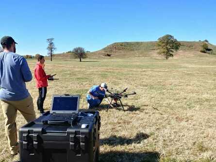
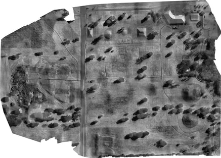
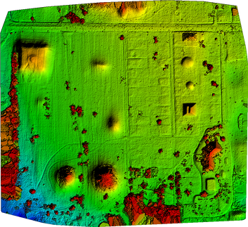
Research at CahokiaSLU’s Remote Sensing Lab is bringing the most advanced geospatial tools to the study of archaeological questions at Cahokia. Current research questions include the positive identification of features at Cahokia to enhance our understanding of landscape use and modification at the site through time. To this end, the lab flies UAVs to collect very high resolution RGB, multispectral, and thermal imagery, which are then processed to create high resolution 3D models, orthomosaics, and vegetation indices. These investigations have highlighted areas of interest at Cahokia and given us new insight into using geospatial technology for archaeological research.
|


